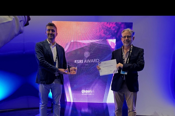
San Diego/Rome - The Food and Agriculture Organization of the United Nations’ Data in Emergencies Information System (DIEM) has been awarded a global prize for special achievement in using geographic information system (GIS) technology by the Environmental Systems Research Institute (Esri), the world’s largest provider of support to geographical information systems.
The FAO DIEM team received the Global Humanitarian Sector Prize for its innovative use of mapping and analytics technology at Esri’s Annual User Conference in San Diego (United States) on Wednesday, 12 July 2023.
Since its launch, during the first wave of the COVID-19 global pandemic in 2020, DIEM has made it easier for decision-makers to assess the acute food insecurity of agricultural households and analyse the key drivers when such shocks occur.
Driven by regularly collected primary data, combined with geospatial data, DIEM is a groundbreaking tool in terms of its size, sophistication, quality and speed. This is the first time that data focusing on agricultural livelihoods in food crisis contexts are being collected on this scale and frequency.
“This award is an important recognition of FAO’s efforts in advancing the use of innovative tools to improve our understanding of the impact of shocks on agricultural livelihoods,” said Rein Paulsen, Director of the FAO Office of Emergencies and Resilience. “The DIEM work has great value as it provides insights into complex emergency situations. This allows FAO and partners to improve actions taken in anticipation of and in response to crises affecting millions of farmers and pastoralists worldwide.”
"Users across all industries continue to show the groundbreaking possibilities of what GIS can help them accomplish," said Jack Dangermond, Esri founder and President. "I am honoured to recognize all the organizations for the many ways they are taking a geographic approach toward meeting some of the most pressing challenges our world faces today."
Through the DIEM initiative, regular household surveys are conducted in more than 25 of the world’s most food insecure countries and each year approximately 150 000 rural households are contacted per year, representing the status, difficulties and needs of more than 650 million people.
In addition to this monitoring work, the DIEM team organizes impact assessments of particularly large sudden-onset disasters. This has enabled FAO to understand better the impact of such events on populations dependent on agriculture for their food and income, and thereby to improve its responses to such events. Recent examples include cyclone Mocha in Myanmar, tropical cyclone Freddy in Madagascar and Mozambique, and the recent destruction of the Kakhovka dam in Ukraine. DIEM is typically able to provide the first geospatial images and potential impact assessment figures within 72 hours of a disaster event.
About the prize
Esri, the global leader in GIS technologies, issues this prize once a year for outstanding examples of the use of GIS in different sectors both within and outside the United States of America. The Special Achievement in GIS (SAG) Awards acknowledge vision, leadership, hard work and the innovative use of Esri’s GIS technology. Just one in two thousand organizations throughout the world receive the prize.
The SAG humanitarian sector prize is issued to one organization per year. Previous winners include UN-Habitat, Médecins Sans Frontières, the United Nations High Commissioner for Refugees, the World Food Programme, the International Red Cross and Red Crescent Movement and the Geneva International Centre for Humanitarian De-mining.